Land trusts and landowners donating a conservation easement

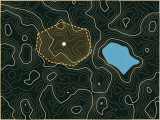
Where is the land under easement?

Free checklist for a conservation easement baseline report: the USGS map, scaled map, aerial photo, site photos and signed statement IRS rules list.

  • Free to read
  • No sign-up until the draft
  • Hands off to the right door

ePlan fills in

  • Easement boundary
  • USGS topo map
  • Aerial photo
  • Land cover
  • Wetlands and streams

How it works

Baseline documentation checklist, from one answer

  1. Enter the easement land and what it protects.
  2. ePlan pulls the USGS map, aerial photo and land cover and lists what the baseline needs.
  3. Use the checklist free. Harvesting timber on the land? Start a forestry BMP plan.

What you get

Baseline documentation checklist and 2 more documents

The check is free. The paperwork after it is drafted at the Harvest BMP plan door.

The first draft

Baseline documentation checklist (free)

  1. USGS map with property line and nearby protected areas
  2. Scaled map of improvements, vegetation and natural features
  3. Aerial photo near the donation date
  4. On-site photo points
  5. Condition of protected resources
  6. Signed accuracy statement by donor and land trust

Modeled on: 26 CFR 1.170A-14(g)(5)(i) documentation list
Next · 2

Forestry BMP plan

  1. Harvest area and access
  2. Streamside management zones
  3. Stream crossings
  4. Skid trails and landings
Next · 3

Annual monitoring report

  1. Visit date and route
  2. Photo points revisited
  3. Changes and issues

From public data

What ePlan fills in, and from where

15 years

is how long unused deductions for a qualified conservation contribution carry forward
Source: 26 U.S.C. 170(b)(1)(E)(ii)

Ready for the paperwork?

Draft a harvest BMP plan: streamside management zone widths, stream crossings and skid trail layout from your tract map. Free to read.

Harvest BMP plan →

Questions

Baseline documentation checklist: what people ask

What goes in a baseline documentation report?

IRS rules list USGS survey maps showing the property line, a scaled map of improvements, vegetation, flora and fauna, land use history and natural features, an aerial photo taken close to the donation date, and on-site photographs.

Source: ecfr.gov

When must the baseline be done, and who signs?

If the donor keeps rights that could impair the conservation interests, the donor must give the land trust the documentation before the donation. The donor and a land trust representative sign a statement that it accurately shows the property.

Source: ecfr.gov

How much of an easement gift can I deduct?

Up to 50 percent of your contribution base, or 100 percent for many qualified farmers and ranchers, with any excess carried forward for 15 years.

Source: law.cornell.edu

The rules this door follows